Discover the Green Side of Singapore - Eco-Friendly Attractions and Urban Nature

Visit the Southern Ridges at first light: a scenic hike that links Kent Ridge Park, Telok Blangah Hill Park, and Henderson Waves. Turn a corner on Henderson Waves and you’ll enjoy sweeping city views and cooler air. Move at a comfortable pace to spot native birds and shade-loving plants along these corridors. This destination blends city views with quiet pockets of green, inviting family trips and solo explorers alike.
National parks teams offer programs that let you join guided walks, citizen science, and tree-planting days. That environmental focus extends from mangrove boardwalks to canopy trails, with a steady supply of knowledge and hands-on experiences and accessible routes. These efforts allow visitors to see firsthand how city planning sustains habitats while keeping streets lively.
Researchers from a university program and workers collaborate on urban-nature projects, boosting diversity in habitats and in data. You can read about campus studies and share a comment on findings, while the city broadens green corridors across months of development. A balanced debate shapes how growth and green spaces coexist, ensuring results benefit residents and visitors alike.
Planning your visit with family in mind? Look for family-friendly routes and educational stops near parks, where kids learn about pollinators, drainage, and water cycles. For international travelers, national programs provide benefits and practical tips on transit, weather, and safety. When you plan your visit, share your comment and help others pick their destination for a green city break.
MacRitchie Reservoir hike: route options, distances, elevation, and time estimates
Packing list, clothing, and safety tips for tropical hikes
Start with a single rule: wear breathable, moisture-wicking layers and pack a lightweight rain shell. This approach yields clear benefits across humid asian trails and supports your energy during the entire ascent.
Clothing and gear: choose lightweight, quick-dry fabrics. Use closed-toe shoes with good grip and bring two pairs of socks. Include a wide-brim hat, sunglasses, and a compact rain jacket that easily folds into a side pocket. Pack a long-sleeve sun shirt, quick-dry pants or shorts, and a small towel. Add a rain cover for your backpack and a dry bag for electronics. If you bike to the trailhead, lock the bike and keep valuables in a dry bag. For the entire hike, carry extra layers for shifting temperatures. If you encounter a waterfall, wear grippy shoes and test footing before stepping on slick rocks. Follow a simple packing process to keep items accessible.
Hydration and nutrition: carry at least 1.5-2 liters of water per day in hot, humid conditions and use electrolyte sachets to prevent cramps. A lightweight filtration system or purification tablets keeps you going when you find streams. Plan snacks like nuts, seeds, dried fruit, and energy bars to maintain energy between shade stops. Consider a hydration vest or belt to keep liquids accessible, with several ways to drink regularly and reduced dehydration.
Safety and planning: carry a map, compass or offline maps on your phone, and a compact headlamp with extra batteries. Include a whistle and a basic first-aid kit. Use sunscreen from local producers and insect repellent to deter bites. Tell a friend about your plan and a rough return time; leave a comment with specifics if you can. Sign up for programs within asia that teach trail risk and local flora and fauna. Enhanced safety steps include having an emergency contact, identifying exit points on the trail, and knowing how to turn back if conditions worsen. If you pick a route, confirm it matches your fitness level and the expected time to complete it.
Fitness and pacing: strengthen ankle stability and leg endurance through regular walks and light strength work. Start with a conservative pace and take frequent rests in shade to avoid heat exhaustion. In areas with streams or near a waterfall, test footing and avoid wet rocks; adjust pace for heat and humidity. Considering heat and humidity, adjust pace.
Living options and care: for overnight stays, consider dormitories or homes near trails. If you used gear, sanitize before next use and check gear picked up from rental shops for wear. Choose gear that is lightweight and easy to carry during long days. In asia, prefer local shops and producers for gear and supplies to support a smaller footprint, and pick items with minimal packaging. Look for storage options you can access after your trip and plan to do basic laundry at dormitories or hostels.
Public transport plan: reaching MacRitchie and other eco-attractions without a car
Take the MRT to Caldecott or Botanic Gardens, then board a feeder bus toward MacRitchie entrance. From the stop, a 5–10 minute walk or a casual cycling ride along the Park Connector Network alongside the reservoir brings you to the Treetop Walk. Early planning with the official electronic MyTransport.SG planner helps you avoid delays, and the route would cut waste and vehicle use while keeping your day plain and enjoyable.
MacRitchie access: practical steps
- Choose Caldecott MRT (Downtown Line) or Botanic Gardens MRT (NS Line) and check real-time feeder options in the official planner to minimize waiting.
- Board the feeder toward MacRitchie and alight at a stop near the gate; the distance to the entrance is walkable in good weather.
- Walk 5–10 minutes or cycle along the Park Connector Network (PCN) that runs alongside the water, with designated lanes for safety.
- Return via the same route or loop through nearby eco trails; plan the outing for early hours to enjoy cooler air and fewer crowds.
Other eco-attractions and practical tips
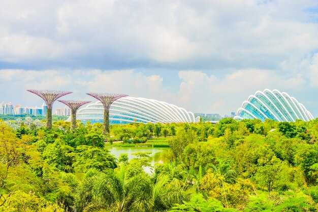
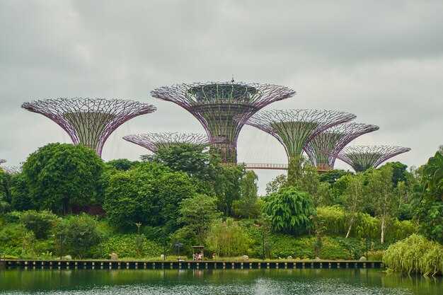
- Gardens by the Bay and Bayfront area: ride the MRT to Bayfront, then stroll through glasshouses that showcase tropical and other plants; this area embodies Singapore’s growth of urban greenery and sustainability alongside a skyline view.
- Singapore Botanic Gardens: reach via Dhoby Ghaut or City Hall and enjoy UNESCO-recognized tropical landscapes with shaded lawns and tranquil lakes; mornings offer active birds and cooler temperatures.
- Pulau Ubin (pulau island): take MRT to Changi Village or Bedok, then bus to Changi Point Ferry Terminal and hop a short ferry to Pulau Ubin; cycle along rustic paths to see mangrove habitats and a living tropical ecosystem with native plants and birds.
- Sungei Buloh Nature Reserve: bus to Kranji, then a short taxi or shuttle to the reserve; observe migratory wading birds and wetlands shaped by drainage channels and tidal flows, a recent highlight in Singapore’s nature map and a recognized sanctuary for biodiversity.
- Sentosa and tanjong beaches (island experiences): from HarbourFront, use the Sentosa Express or boardwalk to access island trails and coastal stretches; you’ll find green spaces and nature trails that pair well with a car-free day.
- University connections: areas around campuses like NUS offer green corridors that align with public transit routes, making it easy to combine study visits with quick nature breaks without relying on a car.
Wildlife watching etiquette: observe birds and monkeys responsibly
Stay at least 5 meters away from birds and monkeys to prevent stress and observe natural behavior. This rule resets expectations for quiet observation and protects their safety.
Stay on marked trails along walkable routes in national parks. The reserve boasts diverse birdlife across habitats; government guidelines and opening hours help keep habitats intact.
Use a long lens or binoculars; this power lets you see real detail without approaching.
Do not feed wildlife or leave scraps. Use recycled bags and green-branded bins to contain waste, and maintain the absence of litter. Respect the forest décor and avoid signs that disturb the habitat.
Keep noise to a whisper; street-level chatter and loud conversations can disrupt feeding, nesting, and resting cycles.
Observe monkeys with care: never chase or touch, especially near troops with juveniles; back away slowly and give them space.
Ask employees or volunteers, such as Chan from NParks, for guidance. They share best practices, point you to safe openings, and explain current rules at the opening of each trail.
Shift away from flashy gear and keep watch in a calm posture; this lets you see natural behavior and reduces disturbance. Lets you enjoy without forcing the moment.
Share tips with fellow visitors; this encouraged approach builds a community of responsible watchers and helps protect their real behavior.
Conclusion: Responsible wildlife watching preserves real behavior and supports the economic value of nature tourism. If you want to protect these species, reset your habits, mind your distance, and report sightings to the government or park staff.
Practical steps for observing responsibly
| Action | Why it matters |
|---|---|
| Stay 5 m away | Reduces stress and preserves natural behaviors |
| Use long lens or binoculars | Powerful view without intrusion |
| Do not feed wildlife | Prevents health issues and habituation |
| Keep noise low | Minimizes disturbance to feeding and nesting |
| Dispose waste responsibly | Maintains absence of litter and decor integrity |
| Stay on marked trails | Protects habitat parts and reduces erosion |
What to bring and how to behave
Carry water and sunscreen for altitude changes on higher trails; wear neutral colors to blend with the environment. Bring a compact notebook to note behavior without interfering, and use recycled containers for snacks to support green-branded park initiatives.
One-day sustainable itinerary: combine MacRitchie with nearby green attractions
Start at MacRitchie Reservoir Park at dawn to feel the effect of cooler air and lighter crowds. Do the Lollipop Trail to the Treetop Walk for a roughly 2.5–3 hour loop, where the canopy creates an invisible shield and a refreshing look over the water.
From MacRitchie, head direction toward Springleaf Nature Park in Woodlands alongside the roads; an omnibus shuttle or short bus ride (about 20–25 minutes) links you to a close, family-friendly circuit that presents an array of forest microhabitats. People in the city frequently choose this sequence for a compact green day.
Springleaf Nature Park offers 2–3 km of trails across boardwalks and forest edges; signs explain the phenomenon of shade and moisture in tropical canopies. A manual map at the entrance shows your options, and the local biodiversity is a hit with Singaporeans. During weekends, visitors were surprised by the richness of species along the trails. The loop features organic plantings and sustainable materials in signage and seating.
For lunch, pick a local cafe near Springleaf that serves organic options and uses packaging-free products where possible. Your choices should favor produce from nearby farms to minimize transport and support eco-conscious farming.
After Springleaf, take transport back to Woodlands Waterfront Park for an easy 2 km seaside stroll alongside the coast. People of all ages, including families, enjoy the shade and the sight of boats and birds. The path offers a calm rhythm for everyone, with benches, shaded spots, and a gentle breeze that helps you reset before the next leg.
Alongside the coast, end your day with a quick debrief on how a single day can connect urban parks with nature. This plan is a master class in sustainable travel, built to work across months of planning and flexible weather. You can pick other close green spots in future visits, choosing routes that reduce car use and maximize public transport, walking, and cycling. For technology lovers, the route uses GPS-enabled maps and simple offline manuals to keep you on track without fuss.


