
When Is Rush Hour in Boston? Your Ultimate Traffic Guide


Depart before 6:45 am or after 9:30 am to bypass the worst congestion. In Boston, the first hours of the day see traffic build-ups across the main corridors. Expect slower speeds on I-90 and I-93 near downtown as people head to offices and appointments. Select a departure window that minimizes time in transit.
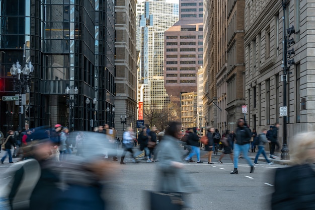
Several key bottlenecks shape the day’s flow across the core: Storrow Drive toward the riverfront, Memorial Drive along the Charles, I-93 through the Financial District, the I-90/Mass Pike ramps into the city, Cambridge Street toward downtown, Boylston Street through Back Bay, and US-1 along the northern edge of downtown. Each route tends to slow first during peak windows, then eases as lanes open or as commercial activity drops after the workday begins.
To cut time on tricky days, adopt flexible routing and buffer at least 15 minutes for typical trips. Use live feeds, predictive maps, and alert apps before you depart, so you can switch to alternate corridors or transit if signs point to a backlog. If you need to run a quick pickup en route, plan it for a window outside peak, and keep your route simple to avoid extra stops in slow traffic. For long trips, consider starting from the outskirts to reach the center via a different approach, reducing the chance of stacking in the central bottleneck.
Data from city feeds show a mix of predictable slowdowns and occasional spikes caused by incidents; the pattern can shift with weather or events. The practical takeaway for visitors is to prepare by choosing a reliable window, keeping a second route in mind, and checking live updates before you move. If you’re visiting from out of town, a transit-first plan often reduces exposure to gridlock, letting you arrive rested and on time.
Most congested corridors in Downtown Boston during 3:30 PM – 6:30 PM
Well, plan to avoid driving downtown during this peak-period. Reduce travel by parking in the suburbs and taking the T to stations in downtown. This approach keeps you on a reliable schedule and minimizes the large delays that tend to occur as crowds funnel into the core.
Regional data showed the highest bottleneck on I-90 inbound and I-93 northbound as they feed into the Financial District, yet surface routes along Tremont Street, Washington Street, and the boulevard segments near Commonwealth Avenue also slow to a crawl. Speeds routinely dip to around 10–15 mph on the worst stretches, and the impact grows during the 4:00–6:00 PM window.
ellie compares regional corridor performance and made a statewide gauge that shows the boulevard and parkway lanes endure the largest effect during peak-period. They found that the surface network around Downtown Boston is more sensitive to volume than peripheral arterials, which helps explain why downtown driving can fail to meet expected travel times unless trips are adjusted.
To reduce impact, either shift trips to earlier in the day or later after 6:30 PM, or embrace transit. If you do drive, use less congested ramps and aim for parking before the core, then ride from stations like North Station, South Station, or Park Street to reach your destination. They showed that rail access keeps speed higher and avoids the worst bottlenecks.
Corridors to watch
In the 3:30 PM – 6:30 PM window, the highest bottleneck shows on I-90 inbound feeding the Mass Pike into the Financial District, while I-93 northbound near Government Center also slows noticeably. Surface corridors along Tremont Street, Washington Street, and the boulevard routes around Commonwealth Avenue carry large volumes and exhibit the steepest speed declines. Storrow Drive, a parkway that feeds into downtown, is often the next bottleneck, especially when events boost regional traffic.
Practical tips
Just plan with live data: gauge conditions at key corridors and choose the route that offers the best speed today. If you must travel downtown, consider leaving before 3:30 PM or after 6:30 PM, and use a suburb-and-rail strategy to reach the core with minimal delay. They demonstrated this approach statewide, and it compares favorably to pushing through the bottleneck with a car.
Practical detours around I-90, I-93, and linked surface streets
Exit I-90 at the Back Bay interchange and route north on Commonwealth Ave, then turn onto Beacon St to downtown; this indicated detour provides reliability and a full, safe alternative during peak days, and youll save time if you switch before 8 a.m. or after 6 p.m., based on live data this path typically cuts congestion by 5–12 minutes. It aligns with local infrastructure priorities to reduce bottlenecks and improve overall reliability.
For I-93 bottlenecks near Government Center, identify Tremont Street and Park Street corridors as primary options; drive Tremont to Washington St, then reconnect to Boylston or Massachusetts Ave to reach the North End or Financial District; this path keeps you off congested ramps and maintains a smoother drive for buses along the route. This gives you additional flexibility. Look for signs indicating alternatives, and if you spot 16th in a block cue, use that as a reminder to switch.
Surface-street patterns that preserve access to places
From the north, use parkways along the Emerald Necklace – Jamaica Way and Arborway – to bypass I-93 spillovers and reach Memorial Drive or the Chestnut Hill district; these routes, whereas less direct, offer steady speeds and reliable signals, and you can find places to park or grab a quick coffee in the george area along the river.
If you approach Boston from the i-84 corridor, stay on surface streets rather than the central interchange to avoid premium delays on the expressways; this approach, based on days with heavy volumes, keeps your drive safer and more predictable while you identify alternative routes in real time.
Best departure times within the window to minimize delay
Depart at approximately 5:50–6:40 AM, 6:45–7:15 AM, or 9:15–9:45 AM on weekdays to minimize delay across most MBTA routes.
This is important for planning.
Three windows cover the patterns you’ll see on city streets and MBTA lines. Early departures dodge the worst ripple effects from incidents on road corridors; there are many routes with different frequency profiles, and the 6:45–7:15 AM block leverages high frequency trains just as crowding starts to rise. The 9:15–9:45 AM slot lets you ride toward the tail of the peak wave with fewer crowds. If you’re traveling on weekends, you’ll see different patterns, but the same windows still apply in many cases.
On rainy days, the same blocks hold, but delays can stretch by a few minutes on black road surfaces, where water reduces traction and slows traffic. Friends reported that several routes slow down when weather worsens, so it’s worth checking real-time updates. There are many routes with different performance, but within the MBTA system, frequency tends to stay higher in core corridors. This leads to a best chance to keep moving even during incidents, provided you pick the right route and departure window.
To stay on track, use a poster-style guide and the station table that summarize the best departure blocks by route. The table, updated by staff, flags limited exceptions such as late-night maintenance or incidents on the road or track that can surge delay. What you choose depends on what you need to reach, and this quick resource helps you plan accordingly.
Weekday vs weekend patterns
Weekdays show a sharp peak around 7:00–9:00 AM and 4:00–6:00 PM; the early window and post-peak blocks help you avoid the worst delay. On weekends, frequency varies by line but generally stays steadier on midday blocks; plan 10:00 AM–12:00 PM or 5:00–7:00 PM to minimize delay as roads are lighter and incidents less common. There are many routes, and the best choice depends on your city location, whether you start near a major hub or a neighborhood route, and the current poster or real-time feed.
Practical tips to minimize delay and use real-time updates
If incidents or heavy rain slow a corridor, switch to a higher-frequency route or a parallel corridor. For example, if the Red Line experiences a setback, use the Orange or Green Line options and connect with a bus feeder to keep your schedule. The MBTA app provides approximate ETA and frequency changes; check it before you leave. You can cut potential delay by approximately five to ten minutes by choosing a different route within the three windows and sticking to it. On rainy days, plan with a margin; the schedule may drift but the overall pattern remains similar. The poster and staff reminders help you stay on track.
Real-time traffic tools and alert setup for Boston commutes
Start by subscribing to Mass511 alerts for your primary corridorsegment and saving these routes in Google Maps and Waze. This ensures you receive safe, timely notices about incidents and bottlenecks, helping you identify efficient options before departure. Configure alerts approximately 10–15 minutes before your usual period on weekdays and during nonrecurring events such as snow inclement weather or roadwork. These steps prepare you for occurrences that disrupt your plan, including large events near Gillette or on weekends when arterials carry extra volume. By staying on top of where congestion tends to cluster along the coast and into maine, you build resilience for both routine trips and wider traffic patterns worldwide.
To maximize impact, tailor alerts to your常-commute sections: save routes that cover I-95, I-93, and key arterials like Boylston Street or Cambridge Street, then layer in camera views and incident feeds. This approach helps you identify bottlenecks early, compare potential detours, and decide whether to depart a bit earlier or shift to a different corridorsegment. Regularly review alert history to spot recurring challenges and adjust thresholds to reduce noise while catching meaningful changes.
Your alert toolkit
Use a combination of official feeds and crowd-sourced data to cover both large-scale events and smaller, nonrecurring hiccups. Mass511 provides official feeds for regional incidents, while Google Maps and Waze offer real-time user reports that reflect current conditions on arterials and interchanges. For a visual check, consult MassDOT live cameras to verify conditions before starting a drive. These tools together help you stay informed where it matters most, including the coast and nearby maine corridors that affect Boston-area commutes.
Tools at a glance and setup steps
| Tool | Data sources | Alerts/Notifications | Setup steps |
|---|---|---|---|
| Mass511 | Official sensors, incident feeds, and camera status for Massachusetts routes | In-app push alerts and email options for saved corridorsegment routes | Create an account, select corridorsegment routes (I-93, I-95, arterial cores), set weekday/weekend windows, and enable nonrecurring event alerts (snow, closures) |
| Google Maps | Real-time traffic, incidents, and predictive speed data | Route-specific notifications when traffic diverges from expected patterns | Save your home, work, and common Boston commutes; enable traffic layer; configure alerts for preferred times and routes |
| Waze | Community-reported incidents, slowdowns, and hazards | Push notifications for your saved routes and corridors | Set home/work routes, turn on alerts, and customize radius to cover arterial corridors and major interchanges |
| Live camera feeds (MassDOT) | Video status from major cameras along arterials and interchanges | Manual checks rather than auto alerts; use visuals to confirm conditions before departure | Bookmark frequently used camera pages (corridorsegments), review during inclement periods or event days, and correlate with other feeds |
Tip: combine alerts from these sources to stay ahead of approximately common bottlenecks. For large events near the coast or in maine-adjacent routes, compare two or more feeds to confirm a single occurrence before adjusting your plan. Keep a short loop of backup routes in your notes, so you can switch quickly if a corridorsegment fills up with traffic.
Common road work and events that spike evening delays
Leave 30 minutes earlier on most weekdays if you must be downtown after 5 p.m.; the late-afternoon spike comes from road work, ramp closures, and event traffic. Use transit when possible and rely on trained city sources and real-time alerts to pick the fastest direction. Know that arrivals can slip behind schedule during this window, so build a buffer into your plan. If you’re planning a ride to a station or from a station, add a 15–20 minute buffer.
Most delays come from lane reductions on highways and tunnel work. In the southbound direction into the city, closures squeeze merges and backups form quickly, with a number of lanes reduced at key ramps. Frequent shifts in closures push drivers toward detours on adjacent routes and the boulevard, adding 10–25 minutes to a typical drive. Recently, crews have intensified work around the tunnel approaches, so expect a higher frequency of stoppages on weeknights.
Evening events at venues along the boulevard and nearby places draw crowds, and arrivals pile up along the same corridors. Most activity peaks between 6 and 9 p.m., with street closures or reduced lanes on routes feeding downtown. Virginia-bound traffic or drivers coming from outer suburbs can see longer delays as they merge onto the same southbound corridors after events. There is no haven from delays; even if you optimize, delays happen. Plan alternatives and check updates before you leave to avoid backing up behind other riders doing the same.
Tips to navigate this: review the latest closures in your area and choose a route with fewer closed lanes; consider taking a different route that avoids the tunnel whenever possible; if you must drive, target a departure window outside the 5:30–7:30 p.m. peak and use transit for the central leg. For late departures, a boulevard feeder road that bypasses the densest work zones can save 15–20 minutes. Keep in mind that the frequency of closures and the arrivals on a given day vary, so check a couple of routes before you leave.
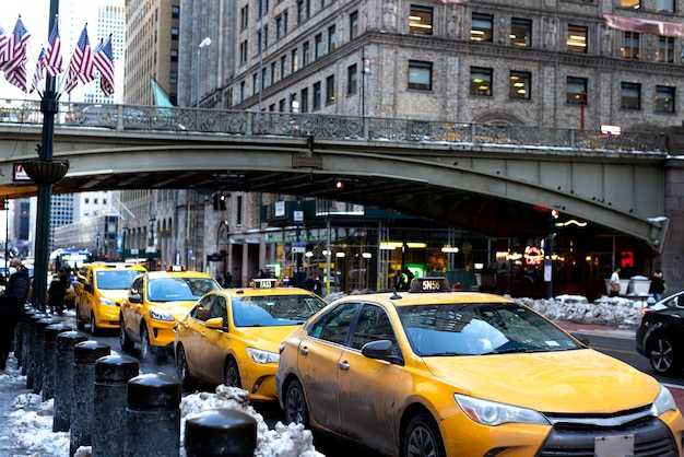
Parking, curb rules, and pickup zones during rush hour
Create a simple plan before you leave and park in a paid garage or official curbside pickup zone during rush hours; this keeps lanes clear and saves time. Rush hours in Boston run roughly 6:30–9:30 am and 4:00–7:00 pm, with heavy volumes around Logan airport, mass transit hubs, and corridorsegment areas. If you arrive by flight, coordinate with your driver to meet at the terminal curb’s designated pickup point to avoid circling. On weekends the flow shifts, but peak blocks still form near hotels and event spaces, so pick a fixed space rather than chasing spots between places. When you’re done parking, walk toward the pickup zone instead of looping the block. The overall congestion is relatively predictable in those windows.
Curb rules are simple: do not stop in active lanes, bus lanes, or crosswalks; loading zones have time limits and require quick pickups. Always check the signs and obey the posted times. The department posts a poster near each curb with current rules, so you can read before you stop. If the first curb is full, use an alternate pickup point indicated by the signage and move toward a safer curb without blocking traffic.
Airport pickups follow terminal-specific curb areas or rideshare zones; plan for a short stroll from the lot into the gate and be ready for average wait times during peak windows. Keep space for other vehicles by choosing a space that leaves room for maneuvering; avoid blocking mass transit entrances. Studies show that clear, designated pickup zones reduce congestion, helping navigating toward the terminal faster. If you must wait, stay in the space and, when possible, avoid lanes near venues serving alcohol. This approach is worth doing to keep rush-hour traffic flow manageable, especially on weekends, when demand shifts and delays spill onto the corridors and parking areas.
MBTA schedules and crowding tips for the 3:30 PM–6:30 PM window
heres a concrete idea: check real-time crowding indicators in the MBTA app and pick a train with lighter occupancy. target trains around 3:40–4:15 PM or after 6:00 PM to dodge the busiest minutes. worldwide datasets show this pattern across major cities, and MBTA availability mirrors it. have a backup plan in case your first option fills up; flexibility saves time and stress.
Line dynamics and timing during the window
- Red Line: aim for ~4–6 minute headways in peak; the core corridor through downtown stays consistently frequent, so boarding in a middle car can help with seating and exit flow at key stops.
- Green Line: trunk segments between Park Street and Downtown Crossing run roughly 4–6 minutes; branches vary, so expect occasional longer waits and more crowded cars along less-traveled segments.
- Orange Line: trains come every 6–12 minutes; plan for occasional gaps, especially when events finish downtown and riders shift to other lines.
- Blue Line: headways around 6–12 minutes; still usable in this window, but expect lighter frequency than the Red and Green lines as you move toward the outskirts.
Crowding tactics and travel options
- Use real-time occupancy data in the MBTA app to pick cars with higher availability; if a car shows heavy crowding, wait for the next train instead of rushing on and fighting for space.
- Schedule flexibility: choose 3:40–4:15 PM or after 6:00 PM to reduce time spent in packed cars; on Sundays or during December events, adjust by 10–20 minutes to account for altered patterns.
- Driving and park-and-ride: if you drive to a station, target parking availability near arterial routes rather than squeezing onto highways during congestion. avoid the turnpike and busy expressways on heavy days when possible, and park near near slower traffic corridors to shorten walking and transfer times.
- Visiting downtown: if you’re visiting for a specific event, consider using a combination route (for example, Green Line to Park Street, then Red Line or Orange Line) to bypass the densest sections at peak moments.
- Seasonal notes: December brings higher ridership in the 3:30 PM–6:30 PM window; plan extra travel time and verify late trains after events or shows. for example, a trip on December 16th may show changed availability compared with midweek days.
- Safety and comfort: stand away from the doors to reduce bottlenecks as trains arrive, hold onto rails during movement, and keep bags close to your body to avoid blocking exits on crowded cars.
- Accessibility: if you ride with a stroller or mobility device, target non-peak boarding cars and station platforms with clearer space indicators; use elevators or ramps where available to avoid delays caused by crowded stairs.
- Nearby options: if your destination is near arterials or bus routes, a short bus transfer from a nearby station can cut time spent wedged on a subway car during the busiest minutes.
- Always have a backup plan: if a line is unusually crowded or a service change is posted, switch to another line or consider a temporary detour via a nearby station to preserve your schedule.


