London Bridge to Charing Cross - Your Essential Guide

Recommendation: Walk door-to-door from London Bridge to Charing Cross when weather allows; the distance is about 1 mile and takes roughly 20–25 minutes at a steady pace, with very direct access and few stops along the way. This makes for a simple, magical river-side stroll through central London.
If you prefer transit, pick a door-to-door route with minimal changes. Both stations sit in Zone 1, so your fare is straightforward, whether you want a fast Tube ride or a scenic bus along the Strand, plan with hours of service in mind. For speed and reliability, check live updates on the map page before you go, avoiding busy corridors during peak times. If you are avoiding stairs, choose step-free segments and minimize stops, and consider routes that keep you within zones you travel through.
Accessibility matters. The route runs through central streets, but accessibility features vary by station. Confirm accessibility for door-to-door travel, especially if you travel with a stroller or wheelchair; check station pages for current hours and any closing notices. For door-to-door planning, use live planners and the page to verify conditions.
Plan a break on the river path to enjoy things like the skyline and magical light on the water. The route offers excellent views, benches, and shade on hot days; take a minute to pause, then continue your path with renewed energy. Please check the page before you head out for the latest updates.
London Bridge to Charing Cross: Practical Guide for London Travel
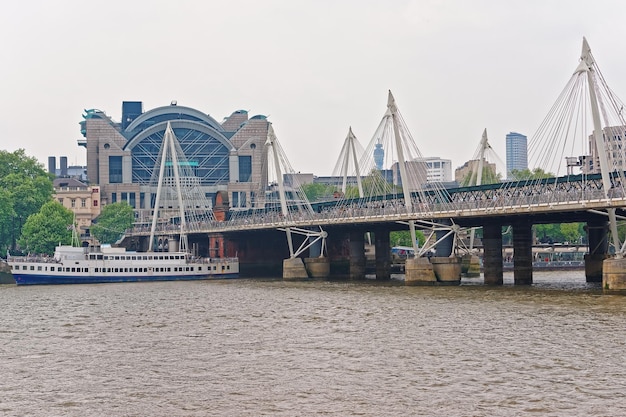
Walk directly along the Thames from London Bridge to Charing Cross for the fastest, most enjoyable option. This 1-mile stretch delivers time savings during peak hours and offers a square of riverside views that feature The Shard, the South Bank, and Whitehall’s grand façades.
The estimated time is 15-20 minutes at a relaxed pace. The route is mostly flat, with helpful crossings and ample spots to pause for photos near classic landmarks in the West End vicinity and around St James's Square.
If rain or fatigue hits, a short bus ride can be a practical alternative. Buses accept contactless and Oyster cards, with price varying by zone and time of day. Use the official link to check live times and service status before you set off. For a quick offline plan, orderthe.
From a practical perspective, walking often outperforms other options during peak hours (07:30-09:30 and 17:00-19:00), keeping you in control of time and rhythm while avoiding station crowds. The route connects smoothly to central west routes and nearby stations such as Westminster and Embankment, making it easy to continue your journeys.
For those planning longer journeys, this corridor can blend with westbound stops toward kensington stations or onward trains to hythe, enhancing your overall itinerary without backtracking. This practical path offers excellent value, straightforward planning, and a clear perspective on how central London links across the river.
Fastest Routes from London Bridge to Charing Cross: Tube, Rail, or On Foot
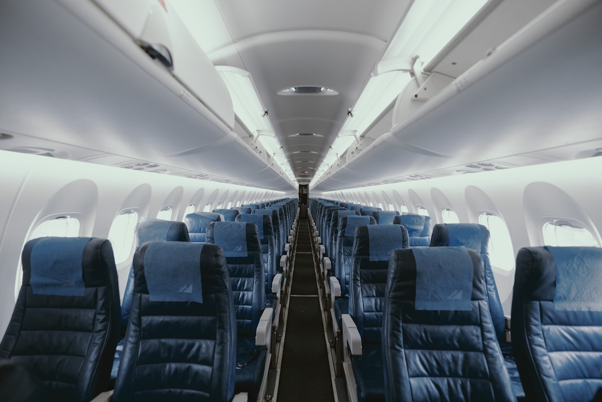
For the quickest option, take the Tube. From London Bridge station, a direct Northern line ride to Charing Cross typically takes about 5–7 minutes, with trains running every 2–3 minutes in daytime. Read live departures on the station board to catch the next train. Payment is flexible: ticket, or cards such as contactless or Oyster, all work; advance tickets can offer lower fares when booked ahead. This option avoids traffic and keeps you indoors, which is handy if you’re carrying a flat-pack bag or heading to a market near Covent Garden. Fans of fast travel will appreciate the Tube; their journeys vary with traffic and running times.
Tube: Direct, fast, and predictable
From London Bridge station, the Northern line offers a direct link to Charing Cross with minimal walking. Running times are stable, but occasionally engineering works or maintenance can alter schedules; always check the readouts. Fares vary by distance and payment method; use advance tickets, travel cards, or contactless cards for a smooth trip. If you’re planning a longer day in the city, you might read about a Sittingbourne connection elsewhere, but for this route the Tube remains the simplest choice.
Rail and on-foot options
Rail: If you prefer rail service, you can switch at Cannon Street or London Bridge to a quick Thameslink or Southeastern service that drops you near Charing Cross with a short walk of about 5–10 minutes. Total trip times typically range 8–15 minutes, depending on connections and street traffic. Fares and ticket types vary; check advance fare offers and use cards to save. In some cases, coaches run during peak demand to support crowds, but trains are the faster option for central London travel. You’ll notice the broader engineering work and vehicle movements around the central hubs; plan in advance and read any advisories.
On foot: Walking remains a solid option if you prefer a direct path and a little exercise. The distance is roughly a mile and typically takes 20–25 minutes. Walking routes go along Tooley Street, the Market area, and the Strand; you’ll pass Borough Market and Cannon Street corridor, with street traffic in the area varying by time of day. If you go this way, check weather and plan your route, then read the map and enjoy the engineering feel of the city on your way. Walking gives you the freedom to observe street life and stop for a coffee or a read at a market stall along the way.
| Route | Typical Time | Transfers | Notes |
|---|---|---|---|
| Tube (Northern line, London Bridge → Charing Cross) | 5–7 minutes | Direct | Trains every 2–3 minutes in daytime; pay with ticket, cards, or contactless |
| Rail (via Cannon Street / London Bridge) | 8–15 minutes | 1 swap | Check live departures; fares vary; some services may involve Coaches during peak demand |
| On foot | 20–25 minutes | – | Distance ≈ 1 mile; traffic may affect nearby streets; pleasant route near Borough Market |
Walking Routes and Estimated Times Between London Bridge and Charing Cross
Recommendation: Choose the Cannon Street–Fleet Street route for the fastest journeys between London Bridge and Charing Cross. The distance is about 1 mile (1.6 km) and you can expect 20–25 minutes at a steady walking pace along stone pavements in the central district. This path keeps you on straightforward streets and reduces delays during peak hours.
Route 2: The scenic riverfront option offers various district views and a more relaxed tempo. Start at London Bridge, stroll along the South Bank and Embankment, then head toward Charing Cross. This path covers about 1.3–1.6 miles and takes roughly 28–35 minutes, depending on crowds and how long you pause to catch the setting sun or a riverside cafe. Notice the wide riverside paths and plentiful seating along the way.
Route 3: A longer, custom detour through Covent Garden, Trafalgar Square, and toward the charing Cross area offers a richer atmosphere. This 1.6–2.0 mile option runs about 35–45 minutes. Those who want more culture can add theatre or gallery stops along the route. The pavements are mostly stone, and crossings at busy junctions may slow you a bit during peak times.
Accessibility and notice: For accessibility, both routes use flat, well-kept pavements with frequent crossings and clear signage. The Cannon Street route has shorter crossing gaps, while the river route gives wider footpaths and step-free sections where available. Walking mode is straightforward, but during peak hours (roughly 07:30–09:30 and 16:00–18:00) expect crowds near key district hubs and the Charing Cross area. Times below reflect typical conditions and can vary with events in nearby Kent or Buckingham districts.
Plan your journeys with a custom approach: use the shorter 1 mile route for a quick run, or extend your plan toward Kensington and Kent districts if you have the time. For fans of urban architecture, the stone façades along Cannon Street and Fleet Street offer frequent photo opportunities. If you need extra help, follow the notice boards at stations and choose a different walking mode to finish the final stretch to Charing Cross. Those journeys can be tailored, and those who want a longer day might even imagine a detour toward Ramsgate–though it would add many miles.
From Charing Cross to Key Destinations: Trafalgar Square, Covent Garden, and The Strand

Start at Charing Cross Station and simply walk along the Strand toward Trafalgar Square. The tower of Nelson's Column anchors the square, and the open space is free for quick photos or a relaxed pause. The National Gallery museum sits on the north side, with a detailed guide map available at the entrance. Covent Garden comes next, where magical energy fills the lanes, street performers entertain, and the market stalls offer plenty of things to sample. This compact loop keeps you within easy reach of central london stations and fits nicely into a half‑day plan.
Walk plan and highlights
Step 1: Charing Cross Station to Trafalgar Square – about an 8–10 minute walk. Step 2: Trafalgar Square to Covent Garden via Seven Dials or along the Strand's side streets – 8–12 minutes of steady walking. Step 3: Covent Garden to The Strand for a final riverside stretch, with additional chances to spot signage toward tonbridge or beckenham if you’re planning broader rail links. If you want to extend, loop back toward the river and explore more pubs and lanes along The Strand. The route remains viable for a quick morning or a relaxed afternoon.
Practical tips
mondays tend to be lively from late morning, with crowds rising at peak times. The route uses several stations, so you can alternate walking with a quick tube hop if you prefer; drive if you need to cover more ground, but expect restricted parking. A google guide or other travel app helps with a detailed map and category filters to keep you on track. Some market stalls are free to browse, and payment options are common; card payment via card machines makes purchases smooth. stationadditional connections offer paths to tonbridge, ramsgate, beckenham, and beyond via the jubilee line or other lines. This plan stays within a comfortable distance and works well for a compact exploration of central london landmarks. Always check live updates before you start to stay on top of crowds, weather, and service changes.
Ticketing: Oyster, Contactless, and Travelcard Use Across Central London
Get an Oyster card or set up contactless payment now to move across central london with ease, whether you start from London Bridge, Charing Cross, or another hub. For traditional tickets, you can still buy a paper option, but the digital methods avoid extra lines.
Touch in on the yellow reader when you enter a Tube station and touch out on exit; this applies across Tube, Bus, and Rail networks. Read the information on the reader or station map to see your current cap and any line-specific notes that may affect your setting and fares, especially as prices can be changing over time.
Oyster Pay As You Go offers daily caps, and Travelcard options remain for longer stays; various weekly or monthly passes can be loaded on an Oyster or carried as a private paper card. An excellent option for longer stays is to load a Travelcard onto your Oyster, which has replaced old paper tickets in many settings, making travel across central london straightforward. Some routes remain expensive if you buy single tickets; compare your line to choose the right setting for your visit.
Planning a museum visit or lunch near cannon street or other central locations is straightforward with Oyster or contactless. You can move along major road arteries and tube lines in central london using one setting; check the map at each station to pick the best path to your museum or restaurant, and read the information sheets near the gate for service updates.
Always read the information on the ticket readers and at a station screen; it confirms the cap and the amount charged. If you have trouble, visit a staffed ticket office for advice, and the team can help you choose the right option or replace a card if needed. Absolutely keep your eye on the reader display for any warning or limit updates.
Accessibility and Mobility: Step-Free Paths, Elevators, and Busy Platform Tips
Plan a step-free route using the TfL app and heading toward a platform with working elevators to travel without stairs.
These district routes are widely used by travelling passengers; these lines connect central areas, and on thursday crowds vary, and sometimes a train may stop at a different platform. Always confirm which lift serves your platform, and check if the stop you plan to use is active, since sometimes maintenance or service changes occur. If there is even a single step, use the lift.
On busy platforms, very important actions include letting alighting passengers exit first, then boarding, and staying behind the yellow line. Also, such guidance from staff is advised; sometimes this makes a difference. Always follow directions and look for staff if you need help.
Elevators and machines: machines can be slow during peak times; accepted payments are usually contactless; services vary and within hours of operation some lifts may be out of service. If an elevator is out of service, staff can advise on the nearest step-free alternative.
From outer districts like bexley, vary your plan by heading to the nearest step-free hub rather than forcing a transfer through crowded sections; these options are accepted and widely used by travellers.
To stay ahead, read the signage tower above each platform, confirm heading before you move, and allow time for transitions; these things reduce delays and help you keep to a tight timetable. If you travel with a group on tours, coordinate with the guide to use the lift-access route and plan the stop carefully so everyone stays comfortable within hours of arrival; along the way you may see cannon motifs near the tower, adding a bit of local character to the route.
Practical Stops and Facilities: Restrooms, Wi‑Fi, Cafes, and Luggage Handling near Stations
Plan your stop: before you board the eastbound routes toward Charing Cross, swing into London Bridge’s concourse for a quick restroom visit and a moment to check the live boards on the Wi‑Fi. This convenient move will save you time, especially in december when peak crowds push lines up. You’ll have direct access to essential facilities without walking far, and the stone floors keep everything easy to navigate.
-
Restrooms Restrooms are located in the ticket halls of both stations, with clearly labeled male and female facilities and accessible options. Maintenance is excellent and staff respond quickly to reports. Baby-changing facilities are typically near the entrances, and signage points the way. Please note that during peak periods lines can form; a brief stop here early keeps you moving without delays.
-
Wi‑Fi Free Wi‑Fi is available on the concourses and most platforms. Connect to the official network to refresh live departures and maps; coverage is strong along the link between London Bridge and Charing Cross, and speeds are very usable for quick checks. If you prefer offline maps, save essential routes in advance.
-
Cafes Inside and near the stations you’ll find a mix of coffee shops and quick-service outlets. Opening hours span from early morning to late evening, with december crowds often increasing wait times. To save time, use order-ahead options and pay with Oyster or contactless, which is convenient across these facilities and helps you keep moving without extra delays.
-
Luggage handling Locker options exist near station entrances, but sizes and availability vary; for guaranteed space, check the station’s official page or app before you go. If lockers are full or not present, consider nearby luggage storage services or hotels that offer day-use storage within a short walk. For a door-to-door approach, you can arrange pickup and drop-off services to handle bags, directly connecting your travel with your plan. A custom timetable can help tailor breaks around train times; always check live updates for engineering work that might affect access. Always plan ahead so you don’t miss your next connection.
The Cannon Street entrance can be a convenient option for quick access, and maps often show a direct link between these stations via straightforward routes. Jubilee Line connections add flexibility for your west-to-east progress, and these routes will offer smooth transfers when the main lines are running. Boards may display long-distance destinations such as Margate to illustrate network breadth; focus on your direct eastbound link to Charing Cross, and adjust if engineering work or maintenance blocks a preferred option. Please keep your Oyster card topped up to pay swiftly for travel and nearby cafés along the way, ensuring you move without waiting. These facilities and services are designed to support a very practical, door-to-door experience that stays on schedule even during peak periods.