25 Essentiële Dingen om te Doen in Bogota, Colombia - Tips om het Beste uit je Verblijf te Halen

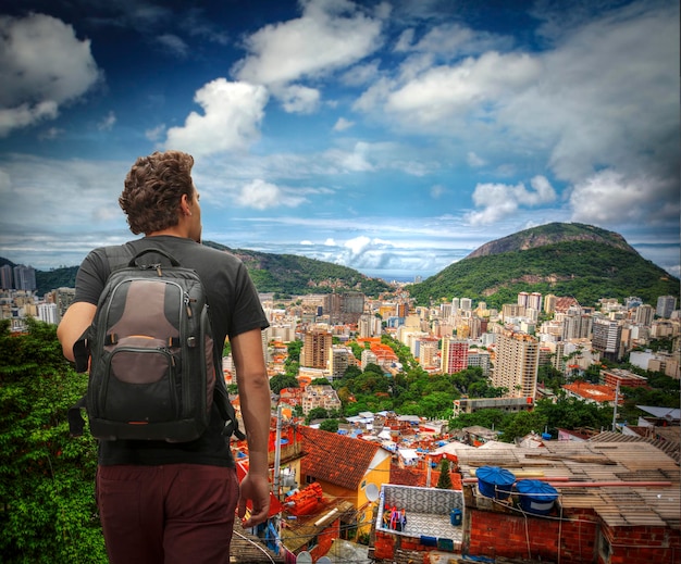

Begin met een rit bij zonsopgang naar Monserrate, neem de kabelbaan en laat de stad zich over de Andes uitstrekken om de juiste toon te zetten voor uw verblijf.
In La Candelaria slentert u door een historische gang met koloniale balkons, straatkunst en een charmante sfeer die u uitnodigt om te blijven hangen in plaats van voorbij te haasten.
Bezoek voor een culinaire pauze een café dat wordt gerund door Jorge García, waar zelfgemaakte empanadas goed samengaan met uien; deze sfeer werd voor velen een herinnering voor vele jaren, en die had u niet mogen missen.
De meeste musea zijn geopend van 10.00 tot 17.00 uur, dus plan een bezoek na een wandeling door het historische centrum; vooraf reserveren helpt om de wachtrijen over te slaan en de dag efficiënt te houden voor een toerist die meer wil doen tijdens een lang verblijf.
Als de avond valt, biedt een buurtclub een warme sfeer met live salsa; een late wandeling langs met lantaarns verlichte blokken kan de herinnering worden die u vrienden vertelt lang na uw reis, vooral als u het lawaai buiten vergeet en in de tred van de stad blijft hangen.
25 Topactiviteiten in Bogotá, Colombia en 6 Nevelwoudtochten op de Cerros Orientales
25 Topactiviteiten in Bogotá, Colombia
Begin na uw landing met een ochtend met gids in het Museo del Oro om oude gouden artefacten te zien en de ambachtelijke geschiedenis van de regio te begrijpen.
De kronkelende straten van La Candelaria bieden kunst, geschiedenis en architectonisch rijke balkons; of u nu snakt naar koffie, cultuur of straatkunst, elke hoek levert kleur.
Neem Monserrate voor een rechte klim en een panoramisch uitzicht waardoor uw voeten tintelen terwijl de stad zich onder u uitstrekt.
Verken Plaza Bolivar en de nabijgelegen bibliotheken en geef uzelf een gevoel van hoe politiek, cultuur en het dagelijks leven hier samenkomen.
Bezoek het Botero Museum om oversized sculpturen en speelse vormen te zien die geweldig en toegankelijk aanvoelen.
Shop op de Usaquén-markt voor exotische ambachten, lokale hapjes en handgemaakte goederen die u hier als cadeau kunt inpakken.
Ontspan in Simon Bolivar Park, bij het meer, en geniet van het ritme van de stad.
Wandel door de Jardín Botánico de Bogotá voor weelderige tuinen en een rustige ontsnapping midden in de stedelijke drukte.
Boek een koffieproeverij bij een lokale branderij via Booking.com om te ontdekken hoe bonen heerlijke kopjes worden.
Blader door kleinere galeries rond La Candelaria voor handgemaakte ambachten en unieke prints van lokale kunstenaars.
Pauzeer voor taarten bij een gezellige bakkerij, waar gebak handgemaakt is en verpakt in kleurrijk papier.
Maak een zeer gevarieerde wandeling langs de streetfoodkraampjes door Chapinero en Teusaquillo om arepa's, empanadas en zoete lekkernijen te proeven.
Bezoek MAMBO en andere hedendaagse ruimtes voor wisselende tentoonstellingen en levendige stedelijke kunst.
Verken Paloquemao Market tijdens de piekuren voor een regenboog aan fruit, kruiden en de baksteenrode gevel die het blok karakter geeft.
Ervaar het nachtleven van Bogotá met clubs rond Zona T en Parque 93 voor een veilige en leuke afsluiting van de dag.
Neem deel aan een architecturale wandeling om eeuwenoude gevels te vergelijken met moderne torens, gedurende eeuwen van verandering, en bedenk hoe ruimtes evolueren.
Huur een fiets en rijd langs de groene corridors van de stad om parken en kleinere buurten vanuit een nieuwe hoek te zien.
Ga langs bij de Luis Ángel Arango-bibliotheek en andere openbare bibliotheken om hier te lezen of te studeren.
Proef streetfoodhapjes die de diverse smaken en vriendelijke verkopers van Bogotá weerspiegelen.
Bekijk een live optreden op pleinen of in clubs waar lokale muzikanten geluiden op uitnodigende manieren combineren.
Bezoek kleinere musea en galeries om lokale verhalen en handgemaakte kunst met een intieme sfeer te ontdekken.
Wandel door Chorro de Quevedo, een levendig plein met cafés, livemuziek en kleur.
Verken de tuinen en binnenplaatsen in historische buurten om de sfeer van oud en nieuw Bogotá hier te proeven.
Neem deel aan een chocoladeworkshop om te leren hoe cacao perfect handgemaakte truffels en taarten wordt.
Controleer, voordat u vertrekt, de dekking van SafetyWing en plan een flexibele route, zodat u zich kunt aanpassen als het weer of de drukte verandert.
6 Nevelwoudtochten op de Cerros Orientales
Makkelijke lus door het bos met gids langs de lagere Cerros Orientales, 1–2 uur, schaduwrijke paden en bemoste stenen.
Wandeling met gids naar een hoge uitkijkpunt, 3–4 uur, gestage klim met weidse uitzichten over de stad.
Watervalpad met gids door nevelwoud, 2–3 uur, met varens gevulde kloven en druipend groen.
Beklimming met gids bij zonsopgang naar een rustig uitkijkpunt, ongeveer 3 uur, koele lucht en gouden licht over de vlakte.
Route voor vogels kijken met een lokale gids door bemoste bladerdakken, 2–3 uur, kleurrijke vleugels boven je hoofd.
Avondwandeling door het bos met een lokale gi