Epic Fall Road Trips Across the US You’ll Never Forget | The Ultimate Autumn Road Trip Guide
Begin with a concrete recommendation: drive the Blue Ridge Parkway in early October to catch the highest color display, comfortable daytime temps, and rivers winding along the NC–TN border. Bring layers, a car charger, and a plan to limit heavy traffic at overlooks by mid-afternoon.
On the West Coast, a Pacific Coast Highway loop from Big Sur through Oregon’s coast delivers cliffs, mist, and towering redwoods. Check official websites for closures and wildfire concerns; this leg is about photography, winery tastings, and easy beach walks along the shore, depending on your interests.
In the Northeast, a fall loop around the Hudson Valley, Adirondacks, and Green Mountains appeals to families. For them, plan a third leg that includes easy boarding options for kids in rental vans and stops at farms, orchards, and museums. The local tourism authority describes stroller-friendly trails, safe parking, and nearby nature centers to engage children while keeping everyone protection from weather and crowds.
Historic routes parallel scenic highways and offer depth: along Civil War paths and old military roads you can detect markers and border fortifications. Official guides describes how to time overlooks and avoid peak congestion, while you plot gentle climbs that hold interest without exhausting the group.
To keep plans clear, divide routes into categories: scenic overlooks, family stops, and food-and-warmth trails. Apply this framework to your calendar, detailing river viewpoints, border towns, and ridge ascents so you can pace the days. That structure helps them stay organized, with lists you can compare on your favorite websites and apps.
As you map the autumn break, carry protection for weather changes, check tire pressures, and review driving tips from the local authority. This guide will hold practical tips on lodging, rest stops, and safety, ensuring you hold momentum without sacrificing comfort for children and adults alike–and giving you a clear path to memorable, photo-worthy moments along the way.
Epic Fall Road Trips Across the US: The Ultimate Autumn Road Trip Guide
Should you crave a crisp, reliable start, begin with a two‑week loop that follows a clear route: Front Royal, VA, along the Blue Ridge Parkway toward Cherokee, then north through Vermont and New Hampshire. This epic circuit delivers dramatic colors, iconic overlooks, and comfortable driving days that let individuals arrive refreshed each evening.
Plan foliage windows with a practical date map: Shenandoah and the Parkway shine mid-October; the Adirondacks peak around October 10–18; the Green Mountain byway holds color October 12–20; the White Mountains show bright birches from late September to early October. Do a quick comparison to decide which leg fits your dates, and use these images to understand what to expect.
To maximize the route, set a flexible pace and pick a few anchor stops per region. Each segment offers specific views that can hold a day or two for short hikes and easy walks; plan to reach the best pull-offs near dawn for the soft light that makes foliage pop. The number of stops depends on weather and traffic, and you should adapt your plan date by date.
For extra motivation, enter the sweepstakes and share a photo from a top overlook here. источник: partner sites publish the official dates and terms.
| Route | Distance (miles) | Best window | Key stops |
|---|---|---|---|
| Blue Ridge Parkway + Skyline Drive (Front Royal to Cherokee) | 469 | Oct 5–15 | Shenandoah overlooks, Mabry Mill, Linn Cove Viaduct, Craggy Gardens |
| Adirondack Northway Corridor (Albany to Lake Placid) | 235 | Oct 8–18 | Lake Placid, Saranac Lake, Whiteface Mountain |
| Green Mountain Byway Route 100 (Brattleboro to Burlington) | 216 | Oct 12–20 | Manchester, Stowe, Smugglers’ Notch, Burlington |
| Kancamagus Highway NH-112 (Lincoln to Conway) | 34 | Late Sept–Early Oct | Lincoln, Hancock Overlook, scenic pull-offs |
Epic Fall Road Trips Across the US: Selecting Your First Unforgettable Route
Start with the Blue Ridge Parkway as your first route. Prioritize a plan that keeps daily drives under 5 hours and reserves time for picnic breaks, short hikes, and visits to local businesses along the path. Take into account their interests and health needs, especially for children; taking deliberate breaks every 2-3 hours helps health and focus. A thousand color displays seasonally await, and the name of your favorite overlook can become a memorable talking point for the group.
-
Blue Ridge Parkway, North Carolina and Virginia
Recommended duration: 5–7 days; total distance about 469 miles. Best timing: early to mid-October for peak color above the valleys. You’ll find overlooks that invite short walks, trails that stay within easy reach, and picnic spots near streams. Plan stops near small towns to support local businesses and to sample regional foods before continuing south or north.
Practical tips:
- Hold reservations or campground bookings well in advance, especially weekends around peak color.
- File any required permits for backcountry access if you plan longer hikes with kids.
- Coordinate with your group to name a few must-see stops, then take turns choosing the next day’s plan.
- Before you go, download the park map automatically and set alerts for weather or road closures; check messages from rangers for safety notes regarding fallen leaves or temporary detours.
- Consent for minors on trails should be documented where required, and all members of the group should carry basic health information in case of minor injuries.
- Are there local sweepstakes or visitor center promotions? Some centers offer small prizes or freebies to encourage exploration of surrounding businesses.
Key spots include Mabry Mill and Waterrock Knob for their iconic overlooks and easy trails. If you plan a family break in fall, you can mix a simple trail segment with a longer drive, keeping the pace comfortable and enjoyable for their interests.
-
Columbia River Gorge and Pacific Northwest Highlights
Distance varies by route segment; plan 3–5 days for a focused loop or 7–9 days if you weave in Portland or Seattle stops. Fall colors spill along the gorge with several short, shaded trails and dramatic viewpoints above the river. Look for picnic spaces near multilevel waterfalls and family-friendly trails that suit all ages.
Practical tips:
- Apply for any required backcountry or campground permits early; areas affected by weather can close temporarily.
- Group planning helps ensure everyone’s interests are met, from photography to short hikes to kid-friendly museums in nearby towns.
- Check restaurant hours and plan meals in town centers to support local businesses.
- Before you depart, file a plan with someone outside the group and confirm rendezvous points in case the group splits for different activity paces.
- Enforcement of trail rules is straightforward here; follow stay-on-trail guidelines to protect the health of ecosystems and visitors alike.
- Overlooks along the gorge offer dramatic cross-river views; keep younger travelers close on busy overlooks and use signage to navigate safely.
Notable areas include Multnomah Falls and viewpoints near Hood River. If you’re traveling with a group, you can rotate who names the next stop to keep everyone engaged while taking turns behind the camera.
-
Kancamagus Highway and White Mountains, New Hampshire
Plan 2–4 days for a focused arc through the White Mountains, with a couple of longer day drives and several short hikes. This route shines in mid-October when the leaves peak above the forest canopy. Expect numerous overlooks, small trails, and a handful of waterfalls to visit on easy paths.
Practical tips:
- Make reservations for lodgings or campgrounds early; in-season spots fill quickly.
- File any necessary passes or permits for specific trail areas and respect posted enforcement notices for safety.
- Take time for a few kid-friendly hikes–Arethusa Falls is a popular option–and schedule a picnic at a scenic turnout.
- Health considerations matter: bring water, snacks, and sun protection; have a plan for sudden weather changes.
- Additional stops can include small towns where you can name a favorite bakery or café and support regional artisans.
- Consent for activities like swimming or cliffside viewing should be obtained when necessary, and adult supervision remains essential on steeper segments.
Arethusa Falls and nearby cascades offer accessible paths with rewarding views. From each overlooks point, you can use simple directions to stay coordinated with the group and keep the driving segments compact.
Additional considerations for choosing your first route: start by weighing the interests of every group member, including children, and how their health needs may influence daily mileage and activity levels. Regarding travel documents, keep a single file of reservations, permits, and health contingencies, and use a single contact point for updates or changes. Before you commit, draft a brief plan that lists the key stops, then share it for consent among the group. Taking a pragmatic approach that honors local businesses, respects enforcement rules, and allows for spontaneous picnic pauses will set a strong foundation for a memorable trip from the first day forward.
The Ultimate Autumn Road Trip Guide: Packing List, Budget, and Safety
Pack a layered jacket, a compact first-aid kit, and a car charger before you depart.
Packing List
For a seven-day autumn trip, assemble seven days of outfits with base layers, a fleece, and a waterproof shell; bring two sturdy hiking boots and one lightweight pair; include gloves, a warm hat, sunglasses, and facial sunscreen with lip balm; carry a reusable water bottle, a thermos, and a mix of high-energy snacks; add a compact personal-care kit, toothbrush, toothpaste, and wipes; include a reliable light source with extra batteries; bring maps (paper or offline app) and a compass as back-up; stock spare fluids (oil, coolant), a tire-pressure gauge, and a small emergency blanket along with a multi-tool; designate a bag for disembarkation day if planned; coordinate with guests so some items aren’t duplicated; for stretches along interstate corridors, plan a hydration and snack routine to stay alert; if you’re traveling on behalf of a family or group, appoint a lead to coordinate supplies; some technical gear like a GPS unit and a satellite messenger can help, plus a basic weather radio for updates; check inquiries for any route restrictions or advisories and adjust plans accordingly; the list describes a practical balance of gear and ease to make the trip smoother; understand how weather and road conditions influence your chosen routes; make sure to consider family interests and the needs of guests, and otherwise be prepared for quick swaps if conditions change.
Budget and Safety
Fuel costs vary with distance and vehicle efficiency. With a 25-mpg vehicle and gas at $3.50-$4.00 per gallon, expect about 0.12-0.16 dollars per mile for fuel, so 900-1,200 miles runs roughly $110-$200. Lodging at midrange motels typically runs $70-$120 per night; seven nights equal about $490-$840. Measured meal costs run $25-$40 per person per day; for a family of four over seven days, budget roughly $700-$1,120. Add park passes, tolls, and activity fees in the range of $20-$60, plus a contingency of $100-$200 for weather or detours near mountain passes like Ouray. Hold a cushion in your plan to absorb unexpected costs. Recognition of fatigue signs matters–pause for breaks every 2–3 hours and switch drivers if possible. Inspect tires, fluids, brakes, and battery; carry a roadside emergency kit with jumper cables, reflective triangles, and a flashlight; maintain a dedicated emergency line and keep inquiries handy for providers or guides; investigate alternate routes if a weather shift appears; if a cruise leg is part of your plan, verify disembarkation options and transfers. Understand that weather can shift quickly in fall, and be ready to otherwise adjust plans. After the trip, analyze fuel consumption, lodging receipts, and the effectiveness of your methods to improve future plans, and discuss any injury risk or incidents with your family and employment contacts as needed. If inquiries arise about providers or park restrictions, contact the relevant providers and authorities for the latest guidance, and keep the line open for quick decisions when needed.
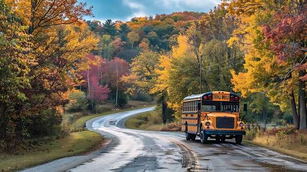
Kancamagus Highway, New Hampshire: Best Foliage Windows, Viewpoints, and Pullouts
Begin at Lincoln at dawn and pull into the first overlook to catch long shadows crossing white birch and gold maple leaves, a moment you’ll want to share with your cameras. The 34-mile road sits along the border of the White Mountain National Forest, offering some of the most recognizable autumn scenery in the region. Peak timing shifts year to year, so plan for two or three nights if you wish to maximize color changes and lighting conditions.
Key approach: target a mix of early, mid, and late-day windows, move slowly, and use pullouts to compare color patches without missing the main road flow. You’ll detect subtle shifts in hue as the wind shifts and moisture returns, so prepare to adapt your plan on the fly.
- Best foliage windows: start with the first 6–8 miles for bright golds around the river bends, then switch to ridgeline views where orange and red maples light up against white granite and deep blue skies, and finish with exposed ledges offering long, panoramic scenes as you descend toward the other end.
- Viewpoints and pullouts: expect frequent pullouts with short trails and safe railings, ideal for quick frames or longer sits. Some overlooks include interpretive signage, others offer simple access to a wider valley panorama–perfect for wide-angle shots and telephoto details alike.
- Photo considerations: bring a tripod, a range of lenses, and a few memory cards; you’ll want long exposures at dawn and the option to crop tight at midday. If you shoot manually, you’ll improve color fidelity by avoiding auto white balance and shooting in RAW.
Photography methods you can rely on: bracket exposures to keep color cast under control, use a polarizer on sunny or partly cloudy days to deepen the sky, and photograph during the blue hour when colors feel most vivid. You’ll find that even subtle color shifts are detectable with careful adjustments to ISO and shutter speed, helping you capture the scene as it would look in person.
- Timing strategy: start early, pause for mid-morning color bursts, and revisit places in late afternoon as the light turns warm. If you’re chasing peak color, consider two consecutive nights in a nearby town and one full day on the byway to cover the most promising windows.
- Gear and access: keep your batteries charged; cold nights drain power quickly. Pack a small warm layer for you and a rain shell for gear. Access points along the road vary, so have a map handy and download an offline version for areas with spotty online coverage.
- Planning and booking: identify lodging in Lincoln or near the White Mountain towns and book ahead, especially on weekends. They would wish for a flexible itinerary that can accommodate last-minute changes if a weather front moves in or leaves a fresh layer of frost.
- Logistics and etiquette: use designated pullouts to avoid blocking traffic, and address parking limits at popular overlooks. Some mornings see advertising signage or seasonal kiosks; treat those as guides rather than distractions and move on if space is tight.
- Practical notes: carry a lightweight tripod and a remote or camera timer to reduce shake at dusk. If you’re driving the full route, plan for a few hours of cruising with optional photo stops, not a race against the clock.
Practical planning tips to include in your trip: check online weather and color reports before you depart, map out a route that balances long stretches with frequent pullouts, and keep a rough credit of miles and times to avoid running late on dark roads. The road is well maintained, but weather can change quickly, so include a buffer for detours or added stops due to strong color displays. Recognized as a premier fall drive, the Kancamagus Highway rewards those who personalize their timing and stay flexible when color shifts occur, offering a classic autumn experience that you’ll want to book into your memory and share with friends.
San Juan Skyway and the Million Dollar Highway, Colorado: Elevation Tips, Weather Prep, and Scenic Sequencing
Start in Ouray at dawn and loop through Silverton and Durango for the best fall color; youll gain altitude gradually, with pullouts for photos and brief rests along the road. Plan to arrive early at Red Mountain Pass (about 11,000 ft) to catch morning light on the peaks, then descend into the canyon and treat your group to a sequence of scenery that includes alpine meadows, aspen groves, and dramatic cliffs. Stops at pullouts offer views which include jagged peaks, gold leaves, and old mine ruins. For a smoother experience, bring warm layers, water, snacks, and a small emergency kit, and keep your speed moderate on the switchbacks. If you feel fatigued, stop, breathe, and let your body adapt before continuing; altitude response varies by person, so build flexibility into planning, including certain time blocks for disembarkation at key overlooks. This describes a practical route and aligns with targeted planning and response protocols from privacyteamnclcorpcom. For your group, you can submit a route name to their organization to tailor alerts and communications, and you can unsubscribe from updates if needed.
Elevation tips
Altitude matters on this route. Ouray sits around 7,800 ft; Red Mountain Pass peaks near 11,000–11,400 ft; Silverton sits around 9,300 ft; Telluride about 8,750 ft. Prepare for thinner air by starting slowly, hydrating frequently, and taking short rests every 15–20 minutes during climbs. Use lower gears on switchbacks and inspect tires before steep grades. For trails and excursions, include easy options near Ouray and Ridgway to build acclimation without heavy effort; these trails provide scenery that complements the road views and can be targeted for quick loops. If you detect dizziness or chest tightness, stop and descend a little; treat fatigue with snacks and water, and plan a flexible driving pace to avoid overexertion. A disembarkation pause at a safe overlook helps you reset before the next leg. Local agents monitor the route and can guide you if weather shifts.
Weather prep and scenic sequencing
Weather in the Colorado high country can flip in minutes; mornings are cold, afternoons can warm rapidly, and snow is possible even in fall. Pack a layered kit, including a wind shell, insulating layer, hat, gloves, sunglasses, sunscreen, and a rain shell. Carry a charged phone, an offline map, and a basic communications plan so your group stays connected; CDOT updates and local agents provide advisories, and you should verify east and west segment conditions before leaving. For provisioning, bring a small emergency provision kit and traction devices if storms threaten. For sequencing, start on the east side to catch dawn light on the peaks, then move toward Silverton and Durango to take advantage of late-afternoon color; this order minimizes backtracking and keeps the road experience smooth. Use frequent pullouts for disembarkation and photography, and maintain a simple response protocol in case of a storm or closure. If you plan with a group, submit a plan including a route name and designated leader; their organization can coordinate updates, and you can unsubscribe from alerts when the schedule stabilizes. Travelers from oceania often value this route for its accessibility and dramatic scenery, and the extra planning helps every member feel confident.
Historic Columbia River Highway and Gorge, Oregon: Waterfalls, Viewpoints, and Gorge Safety
Begin at Crown Point Vista House, west of Portland, at dawn to catch the first light across the canyon. Prepare a concise file with driving order, parking rules, and time windows, then share it with those traveling with you to keep everyone aligned.
Waterfalls and scenery: Multnomah Falls rises about 620 feet, making it the most photographed stop along the route. Wahkeena Falls offers a lush, forested backdrop with a canyon loop, and Horsetail Falls adds a spray-filled curtain near the base. For a near view of several cascades, follow short boardwalks that connect the main viewpoints.
Viewpoints and segments: The highway provides classic viewpoints at Crown Point, Vista House, Rowena Crest, and the Mosier Twin Tunnels area. The route is divided into segments with pullouts, so plan to stop at at least three to four sites. Those stops let you compare west-facing sun on the water and the east-facing mist.
Gorge safety: Rockfall and slick stones affect conditions after rain. Stay within the paved lines and use the line of railings at cliff edges. Guards and rangers serve as guardian figures; obey signs–these regulations protect visitors. If a viewpoint feels crowded or unstable, skip it.
Practical planning: Bring water and layers; check updated alerts from state and federal sites to verify closures or wind advisories. Use technology like offline maps to reduce data usage; the GPS can automatically adjust to detours. For those riding the Gorge Express, boarding is at Troutdale, with a simple schedule; check before you go. Additional stops along the way cover towns such as Hood River, Cascade Locks, White Salmon, and Mosier.
Tips for photographers and interests: this route suits photography interests, with light shifts near different viewpoints. Keep a credits page for your shots and a backup file of notes. Verify weather and air quality before long stretches of exposure, and store needed data about hours, parking requirements, and road conditions. This approach helps you protect your plans and enjoy a smoother day near the river, with those you travel alongside.
Dakar, Senegal: Renting with Welcome Pickups and Navigating Local Roads
Arrive with a confirmed Welcome Pickups reservation to obtain a smooth transfer from Blaise Diagne International Airport to your Dakar hotel. Your driver will be provided with your flight details and will be collected in the arrivals hall, where a sign bearing the person’s name helps you spot them quickly and start your trip with confidence.
From the moment you land, this service reduces stress and offers an epic west-coast experience. If you would like to adjust plans, reply to the emails the team sends and use the publicly posted channels to verify details with the national authority and the operator network.
What to expect with Welcome Pickups in Dakar
Welcome Pickups partners with seven vetted local companies to ensure coverage across Dakar and its westward outskirts. Each ride begins with a trained driver who collects you at arrivals and guides you to a clean vehicle, chosen to match your group size and luggage. The reservation includes a clear price, and the provided driver details are confirmed before you land, so you can plan a long, relaxed first leg of your stay. Testimonials from national and international travelers highlight the consistent experience and the level of care, while those reviews help the company refine practices and keep people safe. The platform collects and publicly shares feedback, which constitutes a useful record for future guests. Emails confirm changes instantly, and the cookies on the booking site personalize the process to your preferences, such as pickup windows and vehicle type.
Getting around Dakar's roads
Plan to move around with a driver who knows the city’s rhythm. Ask your driver for an appropriate route that avoids the busiest sections of the Corniche during peak hours; this choice protects your time and reduces travel fatigue. In general, drive on the right and observe local speed limits; stay aware of pedestrians, market stalls, and cyclists along busy corridors. The authorities set the norms, and your Welcome Pickups driver will follow them, ensuring a safe, efficient experience. If you want to explore beyond the city center, request a longer route or a coastal loop that includes comfortable stops for photos and snacks; those expansions would typically be arranged via emails and confirmed before departure. This approach helps you experience Dakar’s west coast with confidence and peace of mind.
Blue Ridge Parkway, Virginia and North Carolina: Peak Colors, Overlooks, and Campground Planning
Taking enough time in early October on the Virginia side, start with a two‑day loop that links Craggy Gardens, Mabry Mill, and Linn Cove Viaduct. This approach gives you time to adjust for light, which varies by hour and elevation, and to obtain strong images that capture the season’s mood without rushing. The route is recognized by locals for its ability to reveal color shifts across ridge lines, so plan for flexibility rather than a fixed pace.
Overlooks to prioritize include Craggy Gardens for morning haze and long shadows, Mabry Mill for warm, late‑afternoon light, Linn Cove Viaduct viewpoints for sweeping valley shots, and Beacon Heights for broad panoramas at sunset. If you’re shooting, aim to arrive before crowds form and use the light to emphasize texture in the lower slopes and the higher ridges; each site offers a distinct feel that can be captured with a simple frame and a tripod.
Season timing matters: colors begin at higher elevations first, with lower areas lighting up a bit later. In Virginia, peak tends to show in the first half of October, while in North Carolina the best color often peaks late October to early November. For photography, the best light is typically early and late in the day, when the sun sits at a lower angle; carry a small reflector or a compact diffuser to balance brightness at the foreground. If you plan a short stay, focus on two to three overlooks per day and leave room for spontaneous stops based on weather and haze, which can shift the mood quickly.
Campground planning rests on understanding which authority runs each site and what they offer. Reserve ahead where possible; several options lie in Pisgah and nearby forest land, and a few state parks sit within a reasonable drive from the parkway. Check permissions and rights for camping, fire rules, and quiet hours, and consider both primitive and constraint‑free options depending on your preferences. Towns along the corridor–Floyd, Blowing Rock, Marion, and Boone–provide groceries, fuel, and good meal choices for individuals and groups, which helps balance equipment needs and traffic concerns. Local employment patterns can affect availability, so plan for early bookings and be prepared for busier weekends in October. If a roadside site is full, obtain a backup plan in a nearby FS campground or a nearby town, and set forth your backup dates accordingly. источник
To tailor the trip further, gather season‑specific media from official sources and trusted reports regarding foliage conditions. Receive alerts about closures or smoky conditions, and make notes on which images you want to capture at sunrise vs. sunset. If you sign up for updates, you can unsubscribe later if the messages don’t align with your plans, which keeps your workflow clean and focused on your own preferences. For an individual itinerary, draft a simple plan that matches your pace, lodging readiness, and the towns you want to visit, and share it with a friend or fellow traveler for accountability and safety. In short, your purpose is to enjoy classic views with confident timing, while respecting the limits of the terrain and the rights of other visitors.