Getting Around Calgary - Public Transit, Driving, and Cycling Tips


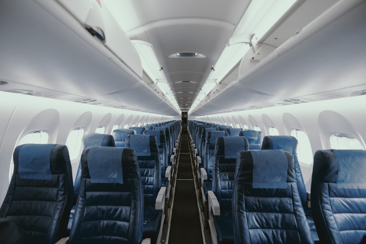
Take Calgary Transit as your default option for most trips today. The CTrain and city buses cover the core routes through the centre and into surrounding neighbourhoods. A rider who buys a monthly pass or uses a mobile fare option can create predictable costs and save time by avoiding cash handling. This option reduces the competition for downtown parking, and the initial setup for mobile tools can take a few minutes to activate.
Driving on deerfoot Trail requires planning. Check live traffic feeds and avoid peak hours; plan ahead for weather and incidents. If you must park downtown, use meters or park-and-ride lots on the edge of the core to reduce downtown fines. For longer trips, you can explore carpooling through ride-matching apps or ask your employer about a company subsidy. If a route changes, transit or road staff may be calling detours; stay with real-time updates during the day.
Cyclists benefit from Calgary's growing network of protected bike lanes and shared paths. Rider safety starts with a quick training on road rules and signaling, and carrying lights for dusk rides. Use a route planner to stay on bike-friendly streets and keep to the centre’s river paths when possible, avoiding Deerfoot’s busy shoulders. Park your bike at transit hubs with a sturdy lock, and if you have requests for signage or lane improvements, contact the city centre cycling team for a direct response in days rather than weeks. This approach can be salvation on wet days when other options are limited.
Choosing a mixed approach keeps you flexible across Calgary’s terrain. Build a routine that links transit legs with short cycles or walks, a model many riders call a smart move. related schedules and route updates appear in one app, and the steps stay simple: pick a route, check status, and adjust for weather. If you work with a company that offers transit benefits, you can stack those savings with a park-and-ride plan. During the week this strategy reduces stress, saves fuel, and aligns with local climate goals.
CTrain vs Bus: Which option fits your typical routes in Calgary?

For typical Calgary routes, choose the CTrain for longer mile-spanning trips along core corridors; use the bus for short hops and neighborhoods not served by rail. If you want to minimize door-to-door time, start with CTrain to a downtown location and use the bus for the last leg instead. Over the year, reliability stays higher on the rail spine than on many local bus routes.
CTrain advantages for longer routes
Frequency on major lines runs every 5–7 minutes at peak, 7–10 minutes mid-day, and 10–15 minutes in evenings and weekends, making it easier to align with work hours or meetings. Wheelchair access is standard with level boarding on platforms and inside cars. This point is illustrated by a khan study in the field background, showing 4–8 mile trips often beating traffic when you ride rail instead of driving, based on regulation and baseline planning. The baseline data also reflect feedback from riders who paid monthly passes. The proximity of location to a stop matters; if you live near a rail stop, the CTrain becomes the quickest option for many mile-length trips.
Bus strengths and pairing with CTrain
Buses fill gaps where rail ends or operates on routes not yet connected, providing flexible service with strong peak headways on key corridors. A baseline plan shows 3–6 minute headways during peak on popular routes, with coverage extended to evenings. They can adapt to traffic, but heavy traffic leads to incidental delays, so plan accordingly. Pairing a bus with a CTrain often saves time on the last mile and reduces parking needs for families or groups meeting at a common location. This pairing helps meet work, study, and family needs. The committee overseeing Calgary transit emphasizes accessibility, safety, and predictable service; staff with a background in urban planning and a field-based approach validate these priorities through regular measurements and the interests of riders who use wheelchairs, students, and seniors. The business case for buses rests on flexibility and local coverage, making them a strong option for routes without rail access.
Calgary Transit Fares and Passes: Compass Card, Day Passes, and Discounts
Get a Compass Card and load a Day Pass to travel quickly around Calgary; this approach minimizes fare paying at every ride and speeds boarding, especially during rush hours. You can apply online or in person, then reload via the official app or at transit kiosks. Check your balance often to avoid interruptions. canada-wide practices influence Calgary's fare design, and the system supports an environment-friendly way to move around the city.
The Compass Card serves as the base for fare management across Calgary Transit. It stores value and supports transfers within a set window, making multi-leg trips smoother for drivers and riders. Cardholders can choose adult, youth, or senior categories, with additional discounts for students and people with mobility needs. The base system is designed to be reliable, and it helps streamline motion across routes and schedules.
Day Passes provide unlimited rides for a 24-hour window, ideal for sightseeing, business trips, or long days around town. simran and lincoln recently used a Day Pass to visit multiple neighborhoods, noting how the pass simplifies motion between destinations and reduces frequent ticket checks.
Where to buy and how to apply
Buy and load a Compass Card at Calgary Transit customer service centers, select Shoppers Drug Mart locations in some neighborhoods, or via the official app. To apply, link your card to your Calgary account, choose your rider category, and set up auto-load if you ride regularly. Base pricing favors high-volume travelers, and the system is designed to scale with the number of trips and time of day.
Discounts, tips, and considerations
Discounts apply for students with a valid ID, seniors, and persons with disabilities; government programs may offer additional subsidies for residents with low income. The pricing structure encourages competition among providers by offering alternative options like ride-hailing partnerships in some corridors, while keeping transit as the backbone of moving around the base network. For visitors, a Day Pass can cover a full day of sightseeing without worrying about exact costs. Don’t forget to check the transfer rules: most transfers are valid for a set window after the first ride, enabling efficient connections across the base system and around the city.
| Fare type | Who it’s for | Typical price (CAD) | Validity | Where to buy/load |
|---|---|---|---|---|
| Single ride (base fare) | Adult | 3.25–3.60 | Per ride | Compass Card, cash at fare machines |
| Day Pass | All riders | 9.50–10.00 | 24 hours | Compass Card, mobile app |
| 10-ride ticket | General | 26.50–28.50 | 12 months | Compass Card |
| Monthly pass | Frequent riders | 105.00–125.00 | 28–30 days | Compass Card, online account |
| Discounts | Students, seniors, disability | Varies | Depends on program | Show ID at purchase |
Smart Transit Planning: Estimating Travel Times and Avoiding Peak Delays
Plan with Calgary Transit’s trip planner tonight and add a 10-minute cushion for each transfer; this advice keeps a rider on track even when a bus bunches or a CTrain delay affects others. In citys like calgarys canada, travel times during peak hours have taken 15–20 minutes longer than expected, so the cushion has been proven to reduce stress and keep you moving. If you need to arrive at a meeting or visiting a site on the north-south corridor, this approach ends the guesswork.
Estimate travel times with a two-step method: base time from the planner, plus 5–10 minutes for walking and 5–10 minutes for waiting per transfer. Travel times also depend on headways: peak trains typically run every 6–8 minutes, buses every 8–12 minutes; off-peak, trains run every 7–9 minutes and buses every 12–15 minutes. For trips crossing the stoney corridor or the north-south route, add 5–12 minutes during peak to cover congestion and signal delays.
Adopt a hub-and-spoke mindset: route to a central centre station first, then switch to regional lines if your path crosses the broader metro area. When visiting field districts or business pockets, a short walk between modes (5–10 minutes) can cut overall travel time and reduce the risk of delays. While you plan, track live updates and call out alternatives by using the transit app to re-route quickly.
Practical tips: check advisories for construction on Stoney Trail and other busy routes; if you encounter a taxi-starved moment at the end of a line, your planner can propose a bus-to-train transfer to cut wait time. If delays lengthen your day, explain the change to your group and adjust plans. Racks at major stations help you stash bags or bikes, making travel smoother for you and others. Calgarys travel scene rewards careful planning: with data, you can avoid heavy delays and keep visiting, work, and daily travel on track, sharing the tale with others in the citys canada context.
Downtown Driving Tips: Parking Options, Meter Rules, and Time Limits
Pay for parking before you leave your car using ParkPlus or the on-street meter; for longer downtown stays, prefer a nearby garage with a clear hourly rate to reduce circling. If you went to a hospital area, you might notice tighter spots and stricter enforcement. For anyone new to downtown driving, a quick training on the ParkPlus app helps you noticed pay options and avoid penalties. The powers enforcing signage operate under multiple regulations, so baseline planning should check the sign and meter before you park. If you didnt bring cash, the app offers a reliable way to pay; it can be salvation when you need time flexibility. Have the license plate associated with the payment method, and keep a hand on the wheel while you read notes from the owner or garage staff. Thank you for reading these tips.
Parking Options
On-street metered spots provide quick pickup and drop-off; pay by card, coin, or ParkPlus. EV charging spots may be available, but charging times can vary; read the sign. Time limits vary by block, and many zones outline a specific duration; a comparative look at nearby garages helps you choose. For longer stays, off-street lots or garages typically offer longer durations and clear hourly rates. If you are the owner of a vehicle fleet, ask the garage about offers or fleet accounts. Understanding the signage reduces surprises, so note the minutes you plan to stay to avoid penalties.
Meter Rules and Time Limits
Meter rules require payment for the duration indicated; mobile pay, cards, or cash are accepted in most spots. Display the license plate number if required by the system; ParkPlus accounts link to the plate. In peak blocks, some spaces prohibit leaving the engine idling or blocking loading zones; respect signs to prevent violations. Vehicles that overstay incur penalties, and associated fines vary by location. If you pulled into a space near a hospital, school, or transit terminal, follow posted rules to ensure you aren’t blocking emergency access. Minutes count toward your plan; plan your route with ride-hailing if you anticipate a long wait or a nearby appointment. With multiple options, a calm approach saves time and stress while keeping you compliant.
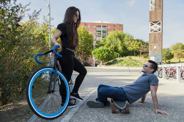
Calgary Cycling Essentials: Bike Lanes, Safe Routes, and Gear
Begin every ride with a concrete plan: ride in routes that use dedicated bike lanes and quieter streets in town, where the bike lane confines keep you near the curb and protect the right-of-way. Check lighting for night riding, and wear high-visibility gear so drivers notice you in low light. When exploring Calgary, use the city’s bike-route map to select corridors that stay within the urban grid, reducing exposure to fast traffic and giving you predictable motion. Keep your attitude calm and focused; a steady pace makes interactions with motorists and pedestrians safer for everyone.
Bike Lanes and Safe Routes
Bike lanes provide protected space along known street corridors and are strongest on main arteries. Always ride in the lane where present and avoid the door zone by keeping a buffer from parked cars. At intersections and driveways, check for turning vehicles and pedestrians; signal clearly and then proceed. Night and early-morning rides require extra caution, so use lights and reflective gear throughout the route. When exploring routes near events, expect surges in traffic and requests from pedestrians; plan a slower pace and larger gaps between riders. For multi-modal trips, know the fares and schedules if you’ll transfer to buses or trains, and look for city-approved connections that stay on the bike network. Only ride in a marked bike lane when provided; if none, stay as far right as practicable. Certain corridors are considered low-stress options; throughout the city, obey legal rules about lane use, yield, and passing. If a driver occupies your space, stay visible, then move to a safer section of street. Drivers, pedestrians, and consumers heading to shops rely on your predictable behavior. The city’s network is working to connect neighborhoods and town centers, so use routes you know and plan ahead for known busy periods, then adjust your path as needed.
Gear and Safety
Equip a purposive city kit: a certified helmet, front and rear lights, and reflective clothing. Include a pump, spare tube, patch kit, tire levers, chain tool, multitool, and a sturdy lock. Pre-ride checks matter: test brakes, spin wheels, and inspect tires for embedded debris. At night, visibility is critical: use bright front lights and a red rear light, and wear reflective ankle bands or strips on your clothing. A wider tire (28–32 mm) provides comfort on Calgary streets; choose tires with good puncture resistance to reduce maintenance. For beginners, durable gear is more important than flashy gear; expensive gear is worth it if it lasts and fits your use. If you have a crash or mechanical issue, stay calm, give yourself space, and seek help; in major incidents, contact hospital or emergency services. For legal clarity, carry ID and insurance information to support any requests from authorities or other involved parties. If you miss a ride, you can book ubers, but plan ahead to minimize gaps between legs of your trip. Even when riding with a steady attitude, always check your setup and consider a quick re‑check before leaving home to keep your cycling outside of pain points and expensive repairs.
Mixing Modes: How to Combine Cycling with Transit for Practical Trips
Determine a practical plan: cycle to a transit hub, then ride a rapid line to downtown, skipping traffic and saving time. This means you benefit from both cycling and transit flexibility. This approach can make daily trips smoother. Use maps to pick a station within a comfortable ride and a transfer that keeps you moving. This setup works in most cases and fits students, cyclists, and daily commuters.
Consider two common patterns: cycle to a station and catch the train, or start with transit and pedal the final leg. Considering distance to Airdrie or outer suburbs, you may bike to a park-and-ride and then board. Check the strict regulation for each line; some lines prohibit bikes during peak windows. Use a checker app to confirm which vehicles allow bikes and where racks are located.
Carry transit cards and share a lightweight folding bike to adapt to different routes. In most cases, the common pattern is a bike ride to the station, a short rail leg, then a final pedal to your destination. The competition among modes pushes operators to improve service, and maps show reliable options. For contingencies, consider ubers as a backup and stay patient during transfers. If you know a known route with 4- or 5-star reliability, stick to it. Further, watch traffic around downtown where shared lanes and pinch points require attention; keep cards handy and use the checker to confirm details before you depart.
Is Uber More Expensive Than Taxis in Calgary? Price Factors and Typical Scenarios
Recommendation: Open the Uber app and Calgary taxi apps to compare live quotes for your route; in most short-city trips, Uber is cheaper during daytime, but surge pricing or airport transfers can tip the balance toward taxis. Always check the fare menu before booking.
Price factors that exist and determine the final bill:
- System design and pricing pieces: taxis use a meter with a base fare, distance rate, and time rate, plus possible airport or late-night surcharges; Uber uses a purposive pricing model with a base fare, per-km and per-minute rates, surge multipliers, and service fees; these components sign the pricing structure and vary by region.
- Regional rules and government oversight: rates differ by district; government rules can cap surcharges or require transparent fare components; these rules help determine the level you will pay.
- Winter and traffic: minutes in traffic raise the time portion of the fare; winter conditions slow speeds and boost trip duration, affecting both options.
- Airport and service charges: taxis commonly apply airport pickup fees; Uber can add a small service fee and may include airport-related charges depending on the route; use the app to see the exact total.
- Passenger options and offerings: UberX, UberXL, and other services give different fare levels; taxis also offer vehicle classes; choose the option that matches passengers and luggage needs.
- Payment and receipts: both systems provide digital receipts; valid fare estimates shown in the menu are meant to help you compare before you book. The fare menu explains each charge, and the app data is highly transparent to aid decision-making.
Following scenarios illustrate typical Calgary experiences (illustrative ranges, may vary by time, location, and demand):
- Short city hop (2–4 km, 5–10 minutes, light traffic): UberX usually CAD 7–12; taxi CAD 8–12; Uber often cheaper, but check the live quote to confirm. This is a common decision point for passengers seeking a quick ride.
- Core suburban trip (6–8 km, 15–20 minutes, moderate traffic): Taxi CAD 14–22; UberX CAD 15–22; surge is unlikely in normal hours but can appear during peak periods, shifting the balance.
- Airport transfer or late-night ride: Taxi CAD 25–40 depending on distance and airport fees; UberX CAD 22–32 plus any applicable airport or pickup fees; compare the final total in the app before you go.
- Winter storms or snow days: Travel time increases; minutes rise and prices go up for both options; surge on Uber can intensify during peak demand, while taxi meters reflect longer durations.
- Group travel or luggage-heavy trips: UberXL can be cost-effective for four passengers or extra baggage; a single larger taxi may be cheaper if booked as a dedicated vehicle; compare totals to determine the best fit.
Bottom line: price depends on route, time, and demand. Following the steps above–open apps, compare live quotes, and read the fare menu–you’ll choose the service that best fits passengers and budget. The regional system and government rules exist to keep pricing transparent, and a city councillor may push for even clearer disclosures. The rule came into effect last year, reinforcing the approach. By checking valid estimates in the menu and considering minutes, traffic, and winter conditions, you can determine the most suitable offering for everything from quick errands to lengthy trips.